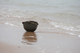
What is the Normandy Landing?
It was the largest amphibious operation in history. Over 150,000 men were loaded onto thousands of ships in Great Britain. They crossed the English Channel during the night and landed in the early hours of June 6, 1944, on 5 carefully selected and studied Normandy beaches (the nature of the sand was even studied). This ultra-secret operation was carried out after months, even years, of preparation. The idea was to set up bridgeheads to bring the men and equipment accumulated in Great Britain during the war to the European continent, and above all to pierce the "Atlantic Wall" erected by the Nazis to set foot on the continent and then take Caen and Paris. It didn't go exactly to plan, but the Landing was a success, and an artificial harbor was built to accommodate the famous bridgehead that would welcome soldiers and weapons and liberate France.
Right up to the last minute, despite numerous twists and turns, the secret of D-Day was very well kept. The soldiers themselves didn't find out it was Normandy until D-Day, even though they had trained on similar beaches in Great Britain, where German equipment had even been reconstructed thanks to information sent to London at the risk of their lives by French Resistance fighters.
We tell the story here:
What are the D-Day landing beaches?
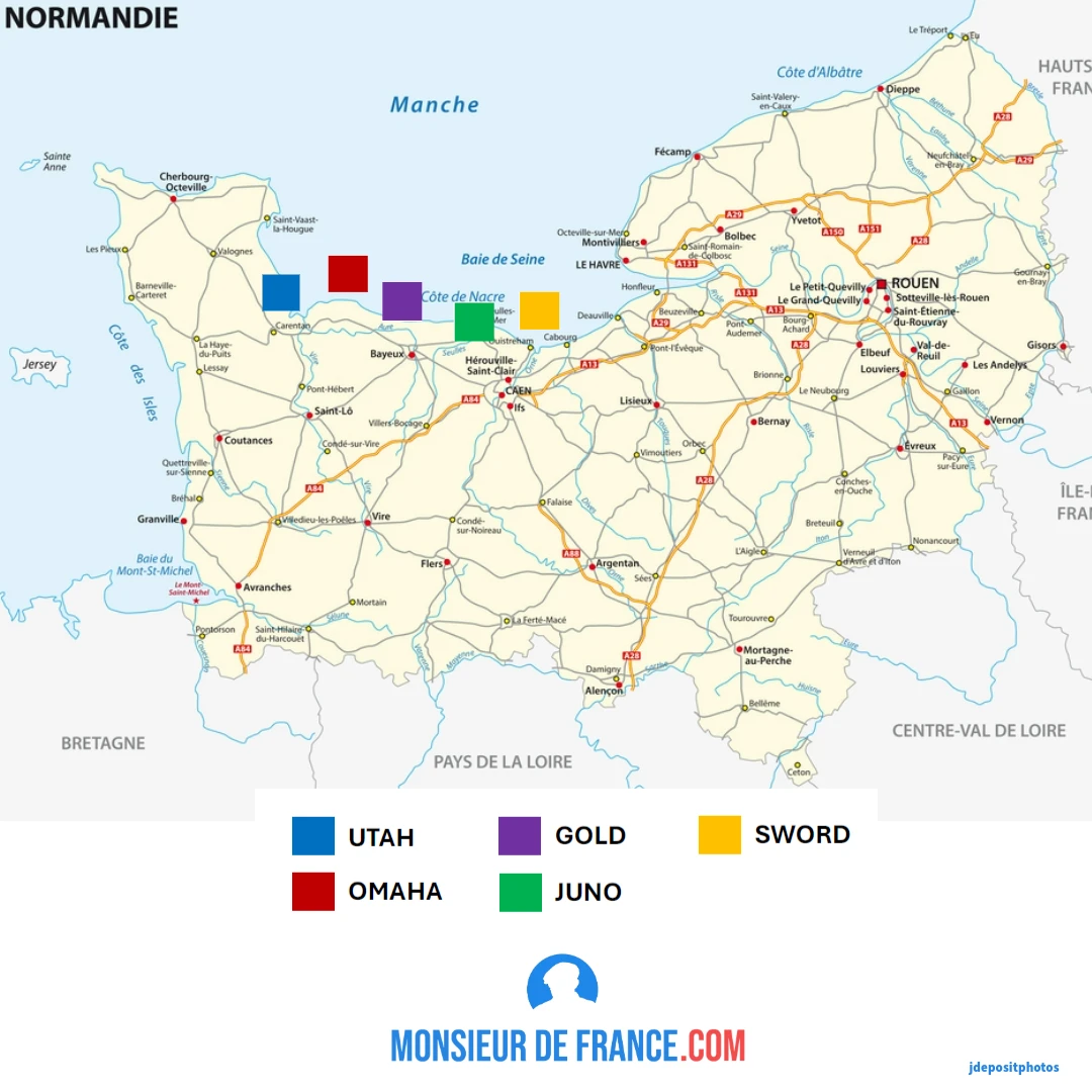
The 5 beaches on the map of Normandy. Illustration by Jérôme PROD'HOMME for Monsieurdefrance.com. Map background: Lesniewski via depositphotos.
Where do the names of the D-Day landing beaches come from?
There are 5 of them: Omaha, Sword, Juno, Utah and Gold, named a few months earlier. American General Omar Bradley chose two names from the state of Nebraska, where two of his non-commissioned officers were from, one from Utah, the other from Omaha. True to their habit of giving names so banal as to be eccentric (such as "mulberry" for the huge artificial harbor), the British chose "goldfish", which became Gold, Swordfish for Sword, and Jellyfish for Jelly. It was Churchill himself who told General Montgommery that Jelly sounded like jam and that the name didn't fit. It was the Canadian commander Dawnay who proposed his wife's first name: Juno, and it was accepted (you can like funny names, but at some point you have to stop, Churchill must have thought...).
They are scattered along the Normandy coast between the right hip of the Cotentin peninsula and the Calvados department. They are as close as possible to Caen, which must be taken quickly (and it won't be). On these beaches, the Allies intend to land 150,000 soldiers, tanks and trucks in the morning... And then continue every day. So they needed a port. And since the Normandy ports were in Nazi hands, the Allies went so far as to create an artificial harbor in front of a beach to continue their operation. 2,000,000 soldiers disembarked over several weeks thanks to this installation made of concrete blocks brought from Great Britain.
The 5 DDAY beaches
Omaha
Omaha beach and the cliffs the rangers had to climb to catch the Germans at bay. Photo chosen by monsieurdefrance.com: Foto-Peter via dépositphotos.
Allied nation on the offensive: United States of America.
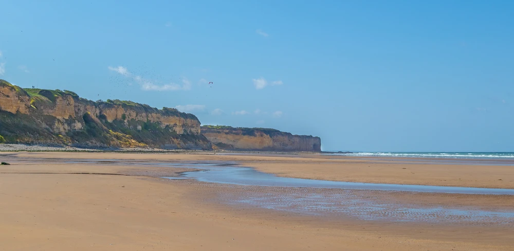
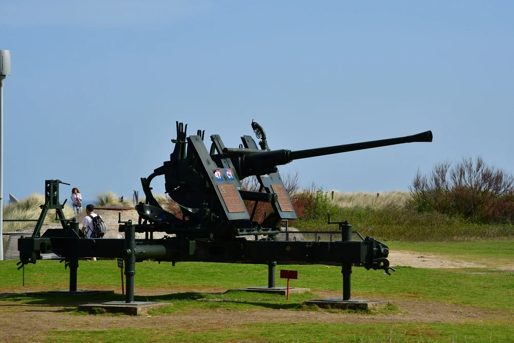
Nicknamed "the bloody one", so many American soldiers fell. It was on this 8 km beach that the Allies lost the most soldiers (1,000 killed, 2,000 wounded or missing). 34,250 American soldiers landed against 2,000 German soldiers in blockhouses. Even before the soldiers set foot in the water, the shoreline was riddled with booby traps, such as the "Czech hedgehogs", made up of beams linked together and often armed with mines, stakes topped with mines that detonated the barges in which the soldiers were seated.... When they manage to land on the beach, they come under fire from German positions. The Germans were in full possession of their resources, since the previous aerial bombardment had completely destroyed the German installations. The fighting was so fierce that for a moment the American command considered abandoning the beach. Faced with the impossibility of taking the well-defended paths leading off the beach, the Americans decided to climb the numerous escarpments overlooking the beach . They succeeded, at the cost of many casualties, and caught the Germans off-guard. At the same time, soldiers attacked the Pointe du Hoc, 30 meters above the sand, from which a cannon was bombarding the beach. The battle lasted 2 days, and the Pointe was taken on June 8, 1944, 2 days after the first assault. Out of 225 rangers, 80 died trying to take Pointe du Hoc.
![Débarquement à Omaha le 6 juin 1944. Image choisie par monsieurdefrance.com : Par Chief Photographer's Mate (CPHOM) Robert F. Sargent, U.S. Coast Guard — Famous Coast Guard Photographs (direct image URL [1])Also The Coast Guard at Normandy "The Jaws of Death" (direct image URL [2]), Domaine public, https://commons.wikimedia.org/w/index.php?curid=43274](https://monsieur-de-france.com/media/cache/ludodev_compress_webp/uploads/images/omaha-beach-1944-monsieurdefrance-1707560235.jpg)
Débarquement à Omaha le 6 juin 1944. Image choisie par monsieurdefrance.com : Par Chief Photographer's Mate (CPHOM) Robert F. Sargent, U.S. Coast Guard — Famous Coast Guard Photographs (direct image URL [1])Also The Coast Guard at Normandy "The Jaws of Death" (direct image URL [2]), Domaine public, https://commons.wikimedia.org/w/index.php?curid=43274
Where is Omaha Beach?
Omaha Beach is mainly located in Saint Laurent sur Mer, and access to the site is free.
Ideal GPS address: rue de la 2e division U.S 14 710 SAINT LAURENT SUR MER.
(there are parking lots). Bayeux is 25 kms away (there are buses from the town to the Omaha site). Caen is 50 kms away.
Where is Pointe du Hoc?
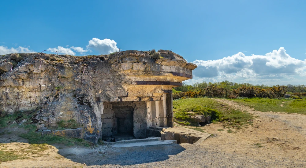
The blockhouse at Pointe du Hoc. Photo chosen by monsieurdefrance.com: Foto-Peter via dépositphotos.
The Pointe du Hoc is located at 14450 Cricqueville-en-Bessin, and access to the site is free of charge.
Ideal GPS address: 11 rue Talbot / Criqueville-en-Bessin.
(there are parking lots). Bayeux is 25 kms away (there are buses from the town to the Omaha site). Caen is 50 kms away.
What to see around Omaha Beach:
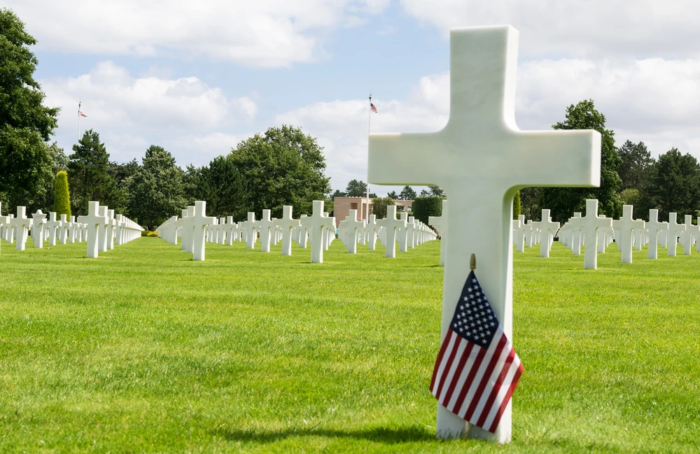
The moving American cemetery at Colleville sur Mer. photo chosen by monsieurdefrance.com: jovannig via depositphotos.
In Saint Laurent sur Mer , the Omaha Beach Memorial Museum. Further afield: the Maisy Battery (in Grandcamps-Maisy), next to which is the D-DAY OMAHA Museum. In Colleville sur mer, a little further still, there's the Colleville sur mer American cemetery. It covers 70 hectares (and is American territory). 9,387 white graves overlook Omaha beach. An exhibition and films tell their story. At La Cambe you'll find the German military cemetery.
Internet sites :
The Normandy tourism site is very well done. It features maps, including one with all the sites to see at the Battle of Normandy.
The Isigny-Omaha tourist office website is well worth a visit.
UTAH
Utah Beach in Sainte Marie du Mont. Photo chosen by monsieurdefrance.com: merc67 via depositphotos.
Allied nation on the offensive: United States of America.
The beach is immense. It's part of the Baie des Veys. It was the first beach to be stormed on the morning of June 6, 1944, by 32,000 men who landed a little further away than expected. During the night, parachutists were dropped behind German lines, in marshes (some of them drowned) and around Sainte Mère Eglise. Their mission was to catch the Germans off-guard. This was the least bloody of the 5 D-Day beaches, with 200 killed. It is also the beach where the D-Day landings were most successful, since it was from this beach that a breakthrough was achieved, enabling the liberation of the Cotentin region, the start of the Liberation of Brittany and, above all, to encircle the Germans from the south in a sort of pocket, the Falaise pocket, which was closed in mid-August 1944 (i.e. more than 2 months after the D-Day landings), defeating most of the German armies that had launched against the D-Day landings, before going on to liberate Paris at the end of August 1944 .
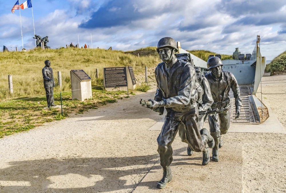
The Higgins Boat Monument pays tribute to the barges built by the Higgins company in New Orleans, USA, which enabled thousands of soldiers to land on the beaches of Normandy. Photo chosen by monsieurdefrance. billperry via depositphotos.
The OO de la Liberté milestone can be seen at the edge of the beach. The Allied route from Normandy to Bastogne in Belgium, 1147 kms away, is regularly marked by milestones engraved with a flame. A symbol installed in 1947. In his book, "Les gens d'ici", writer Gilles PERRAULT recounts that the first milestone, marked 0, was installed in Sainte Mère Eglise, a commune a little further away than Sainte Marie du Mont, which is said to have been the first to be liberated in 1944. The second 0 marker was installed at Utah Beach, in the commune of Sainte Marie du Mont. The painter of the Sainte Marie marker was from the commune and didn't like the fact that Sainte Mère Eglise, located several kilometers from the sea, was identified as the first commune on the path of the liberty markers. He therefore... Added a 0 in front of the 0 of his commune's milestone, and made a milestone that for a long time was OO rather than "just" O as in Sainte Mère Eglise.
Where is Utah Beach?
Utah Beach is located in Sainte Marie du Monde. Access is free of charge.
Ideal GPS address: Voie de la Liberté 50 480 SAINTE MARIE DU MONT.
(there are parking lots). Carentan is 10 kms away. Bayeux is 25 kms away (there are buses from the town to the Omaha site). Caen is 81 kms (1H15) away.
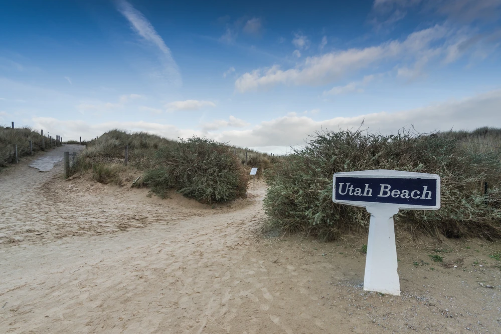
The famous Utah Beach entrance sign. Photo chosen by monsieurdefrance.com: merc67 via depositphotos.
What to see around Utah Beach
The Musée du Débarquement (D-Day Museum ) is complete and will give you a better understanding of what happened. It is located by the beach (admission charge). Along the beach, you'll see many colorful little houses. The village of Sainte Marie du Mont is well worth a visit. Its church is splendid. Further on, in Sainte Mère Eglise, you can see the famous church where an American parachutist hung on all night as the bells rang out the tocsin, the alarm, because of a fire. His comrades landed among the German soldiers, sometimes even in the flames. This scene was immortalized in the film "The Longest Day", and a mannequin hanging from a parachute still stands on the church tower as a reminder of this story. Also in Sainte Mère is the Airborne Museum, dedicated to the American paratroopers.
Internet sites :
The Normandy tourism site is very well done. It features maps, including one with all the sites to see at the Battle of Normandy.
The website of the officein the Cotentin region is well worth a visit.
GOLD
Allied nation on the offensive: United Kingdom of Great Britain.
Gold is one of the beaches where the landings took place a little later than at UTAH and OMAHA, due to the later tide. The operation was entrusted to the British, who lost 1,100 soldiers, including 3,500 killed. Since 2021, a monument has paid tribute to the soldiers who fell here, as well as to the 22,442 British soldiers killed during the Battle of Normandy between June and August 1944.
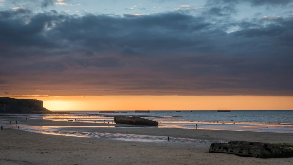
GOLD beach at sunset. Photo chosen by monsieurdefrance.com: mountaintreks via dépositphotos.
Gold is also what might be considered the capital of the D-Day landing beaches, since off Gold, at Arromanches les bains, the Allies arrived with their own harbor . This operation, called "Mulberry" (operation mûre in French), was ultra-secret, and no one knew what these huge caissons in the port of London were used for. It was one of the genius ideas of D-Day. While the ports of Normandy were in the hands of the Nazis, who had erected them as fortresses of the Atlantic Wall, the Allies decided to land... With their own port. The concrete blocks were sunk off the coast of Arromanches to form the terminal of a pipeline from Great Britain. An ingenious system of gangways ensures that unloading can continue whether the tide is high or low. In all, 2,000,000 men disembarked at this artificial port, parts of which can still be seen today.
Where is GOLD Beach?
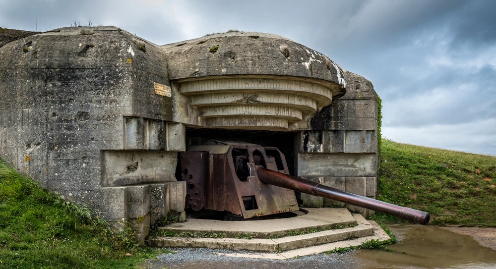
The German gun battery at Longues-sur-mer. Photo selected by monsieurdefrance.com mountaintreks via dépositphotos.
Gold Beach is located between ARROMANCHES, ASNELLES, COMMES and VER-SUR-MER.
Ideal GPS address: Rue Xavier d'Anselme (there's a parking lot) 14 960 ASNELLES. You have Asnelles and Arromanches-les-bains on your left and Ver-sur-mer on your right. On foot, take the Chemin du Marais. You'll skirt the coast and the Bessin marshes. It's 3 kms long. You can also go directly to boulevard de la plage in Ver-sur-Mer.
Alternatively, you can choose to drive to Arromanches, 2 km further west, where you'll find a parking lot at 10 Rue Lucien Joly, 14117 Arromanches-les-Bains.
Bayeux is 19 kms away. Caen is 27 kms away (30 mn).
What to see around Gold Beach
The British monument at Ver-sur-Mer and the German battery at Longues-sur-mer will give you a good idea of how the coast was armed on D-Day. Further afield, in Arromanches-les-bains, you can visit the circular cinema Arromanches 360 and the Musée du Débarquement , also in Arromanches.
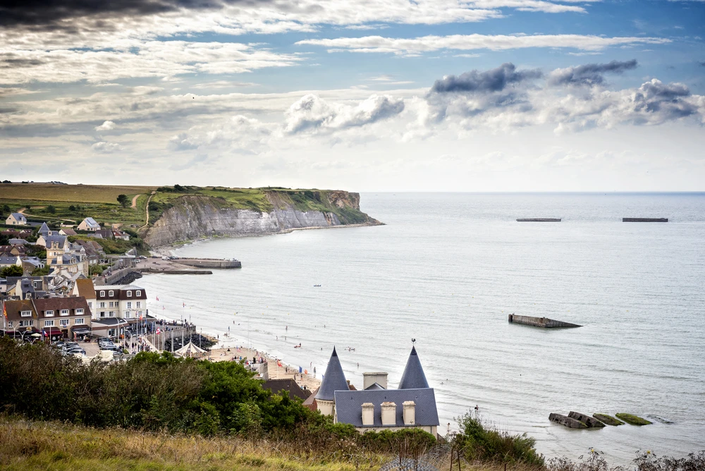
The famous view of Arromanches. Photo chosen by monsieurdefrance.com: massimosanti via Depositphotos.
Internet sites :
The Normandy tourism site is very well done. It features maps, including one with all the sites to see at the Battle of Normandy.
The Calvados website is well worth a visit.
JUNO
Allied nation on the offensive: Kingdom of Canada / United Kingdom of Great Britain and Force Françaises Libres.
Courseulles sur Mer, France - April 22, 2018: the Juno Beach Centre, Canadian D-Day Memorial / Photo chosen by monsieurdefrance.com: packshot via depositphotos.
JUNO is the 4th D-Day beach and one of the closest to Caen, along with Sword. 23,000 men landed on D-Day , facing nearly 8,000 Nazi soldiers (not all of them Germans; some Russians were also taken prisoner). The Allies lost 1,200 men, 500 of whom were killed in action. The aim was to link up with the landings on Sword and take Carpiquet airport, which was Caen's airport. Heavy congestion prevented this from being fully achieved, but even so, the landing was successful .
Where is JUNO BEACH?
The ideal GPS address is: avenue des Essarts 14 470 COURSEULLES-SUR-MER
Bayeux is 23 kms (30 mn) away Caen is 20 kms (20 mn) away.
What to see around Juno Beach
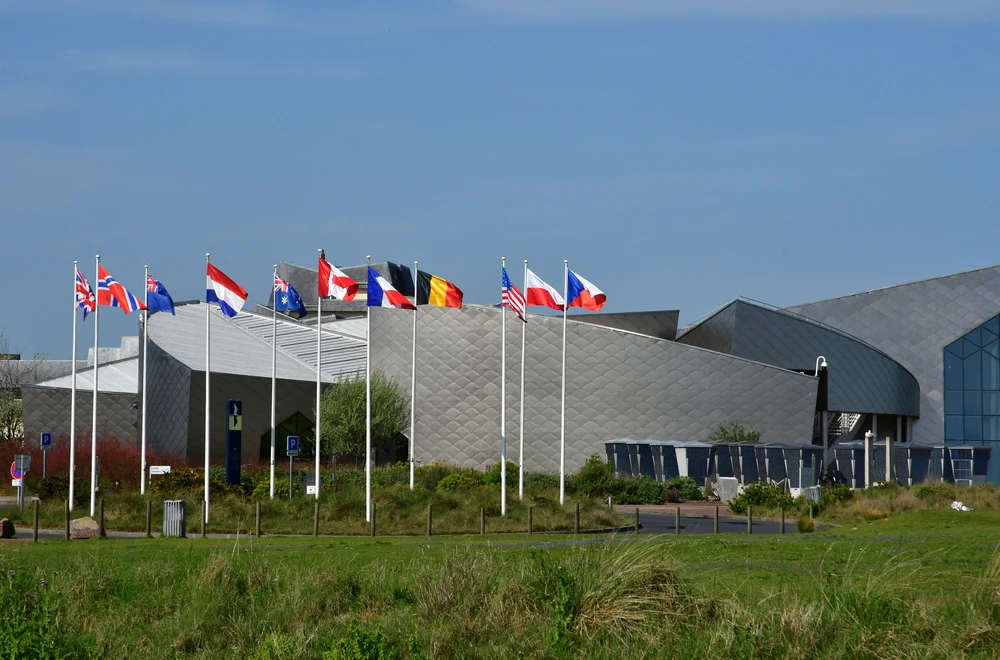
This is the place in Canada whose veterans founded the Juno Beach Centre , dedicated to Canadian soldiers of the Second World War. The memorial center tells the story of where these men came from, evokes their memory and sheds light on Canada's great commitment alongside the Allies in the liberation of Europe. It's a powerful and moving place to visit (admission charge). Canadians are doubly at home in Normandy. Firstly, 5,500 of them lost their lives in the Battle of Normandy, and secondly, many of the first settlers from Quebec and Acadia came from Normandy and the Perche region, a 1.5-hour drive from Mortagne, Bellême and the small village of Bressolettes in the Orne department. The Juno Beach Center is located "voie des Français Libres" at Courseulles sur Mer. Normans were astonished to hear the French from Quebec in the summer of 1944, and delighted to salute the courage of their cousins across the Atlantic.
Juno Beach Canadian Memorial Center. Photo selected by monsieurdefrance.Com / Photo selected by monsieurdefrance.com: packshot via depositphotos.
Also worth a visit: the Maison des Canadiens at Bernières-sur-mer (34 avenue des Français), considered the first French house liberated by the Normandy landings , and was liberated by the Canadians before becoming headquarters for British Admiral Cooper. Well-known to veterans, it is also famous in Canada, where it has been featured on a stamp. Visits are by appointment only, but it's well worth the detour if only because it's typical of the Norman regionalist architecture of the 1920s (it was built in 1928).
Internet sites :
The Normandy tourism site is very well done. It features maps, including one with all the sites to see at the Battle of Normandy.
The Calvados website is well worth a visit.
SWORD
Allied nation on the offensive: Force Françaises Libres and United Kingdom of Great Britain
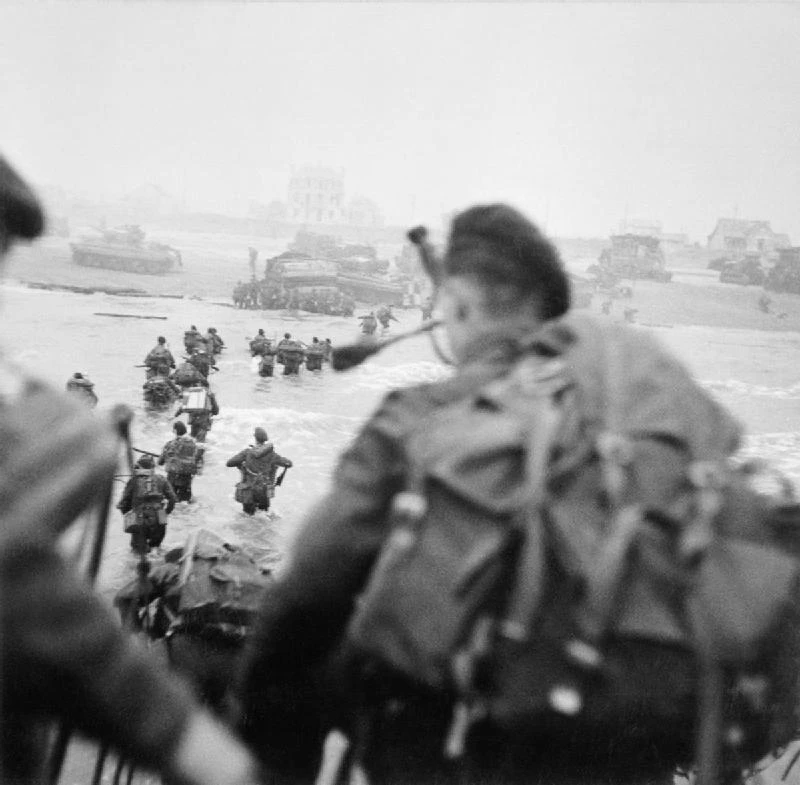
British and French soldiers land on Sword Beach to the sound of piper Bill Milin's bagpipes (right). Source de Monsieurdefrance.com : American public domain via Wikipedia.
The sword beach is immense. It stretches 8 km from Saint Aubin sur Mer to Ouistreham. However, the landing took place in a rather narrow area, as the sandbanks and the tide did not allow for a wider surface area, so the soldiers landed in front of the Riva Bella casino in Ouistreham. It' san even more sacred place for the French, since it was here that the Commando KIEFFER, named after its leader Philippe KIEFFER (1899-1962), landed. The green beret emblematic of the Kieffer commando's Free Frenchmen is still famous today . The last survivor, Léon Gautier, died in 2023.
Where is SWORD BEACH?
Ouistreham beach and port. Photo chosen by monsieurdefrance.com: Smithore via depositphotos.
The ideal GPS address is: Bd maritime, 14880 Colleville-Montgomery
Bayeux is 23 kms (30 mn) away Caen is 20 kms (20 mn) away.
What to see around Sword Beach
You can visit the 3 British cemeteries at Hermanville sur Mer, Ranville and Douvres la Délivrande. There's also the Merville Battery Museum. There's also the museum of Pegasus Bridge, the first Liberated Bridge, whose story is told in the film "The Longest Day", where Piper John Milin is seen playing the bagpipes across the bridge. The original Pegasus Bridge has been dismantled and installed in this museum to preserve it. It is located at 1 rue du major Howard, 14 860 RANVILLE.